Tuesday, May 8, 2012

The Future is Now!!!!

"Warming of the climate systems is unequivocal, as is now evident from observations on increases in global average air and ocean temperatures, widespread melting of snow and ice and rising global average."  (1)

This is an official statement from the Synthesis Report, Climate Change 2007, produced by the Intergovernmental Panel on Climate Change (IPCC). According to the Third Assessment Report  generated by the  IPCC, the 100 year linear trend from 1906 through 2005 is a 0.75 degrees Celsius  increase of temperature world wide. This impacts the state of Florida, regionally, with more hot days or heat waves, more frequent hot extremes, heavy precipitation and increased intensity of tropical cyclones.

Observed changes in global surface temperature, global average sea level from tide gauge and Northern Hemisphere snow cover. All differences are relative to averages from 1961-1990. Smoothed curves represent decadal averages while circle represent yearly values. (1) 


The majority of Florida's low lying coastal communities will be impacted by sea level rise from climate change. Within these communities the mangrove ecosystems and salt marches will be distressed by sea level rise. The increased mean global temperature equates to a significant increase in the mean ocean temperature, where most  flora and fauna systems have slow adaptive capabilities. The 1-3 degrees Celsius increase is projected to result in 'more frequent coral bleaching events and widespread mortality, unless there is thermal adaptation or acclimatisation by corals.' (1) 

To support and update these findings the IPCC presented; The Special Report on Managing Risks of Extreme Events and Disasters to Advance Climate Change Adaptation (SREX). The opening pages define some core concepts like; climate extreme, adaptation, resilience, vulnerability, transformation and disaster risk management. This language  collaborates the predictions for climate change in Florida and how the low-lying state will have to prepare and adjust their current action plans along with their disaster assistance in the near future and well into the twenty first century. (2)

Along with model projections of substantial warming in temperature, heavy rainfall in tropical regions and increased intensity of tropical cyclones; the biggest concern is the increase in extreme sea levels. The sea level impacts erosion, shoreline change and saltwater invasion into Florida aquifers. With just 2 feet of sea level rise, 1.5 million people will be under water. Some 130 billion dollars of residential real estate will be lost, half of all Florida's beaches, two nuclear reactors, three prisons, 37 nursing homes and on and on and on.....

Coastal Florida and Everglades-Sea Level Rise Maps


Current depiction of Florida's Atlantic Coast, the Florida Keys and Florida's Gulf Coast. (3)

Sea level rise 3 meters!!!! With only a few meters, thousands of acres would be inundated with water. Any area south of Key Colony is under water.  The extensive canal system dubbed 'the Venice of the Americas' south of Lake Okeechobee is overflowing. Then finally, the Florida Everglades has extensive intrusion of saltwater. (3)


Finally, sea level rise 6 meters!!!! One picture is worth a thousand words. (3)


With the majority of Florida being less than 12 feet above sea level and home to over 5 million people, the economic consequences are unmeasurable. Disaster losses alone have equated from a few billion US dollars to over 200 billion US dollars with the highest value being in 2005 when Hurricane Katrina hit the Gulf Coast. Tourism is one of the biggest economic drivers in Florida.  The threat of receding beach area, riddled with storm surged,  abandoned property will certainly have a negative influence on any tourism industry in  the 'Sunshine State.' Not to mention that the beaches hold critical habitat for many marine animals. Both short and long term sustainability of the Florida beaches are effected by sea level rise and how frequently the sand is replenished.  
The effects of storm surge on coastal areas in Florida. (4)


Hal Wanless, chairman of the Geological Sciences Department at the University of Miami and advisor to the Dade County Commission states;

"the impact of 5 foot sea level rise would mean that all of Miami Beach and nearly all of the Florida Keys would be gone. Much of Miami-Dade County and much of Broward County would be underwater." (5)

There will be some tough sacrifices ahead for Florida. It will be increasingly risky to live in Florida. Eventually the roads in south Florida will have to be raised and with a five foot sea level rise,  the city of Miami will be virtually an island. The idea of keeping the sea at bay through levees and pumps like the city of New Orleans is not an option. The geography of the area is built on porous limestone that allows rainwater to soak in ---literally this porous rock allows the rising water table to percolate up to the surface. "If we have sea level rise, it will come right through" said Wanless" (5)
Coastal planning and having a comprehensive regional plan for adaption strategies is imperative. Some coastal areas have developed plans, however a large percentage of the coastal communities have not taken on such a monumental task. The new reality is about bringing together the large counties in the state to lead the way. Representatives in South Florida's four counties recently met and agreed to work together to cope with the forth coming issues of climate change and sea level rise. Miami-Dade County commissioner Kate Sorenson says that so far, communities have mostly focused on what they can do to stop contributing----but now it's time to think about how we will adapt to the change. (6)

Sea level rise, THE FUTURE IS NOW!!!


(4)


1. Climate Change 2007:Synthesis Report, Summary for Policymakers, IPCC
3. geology.com/sea-level-rise/florida
4. University of Florida, Finding Florida Sea Grant
5. earthsky.org/earth/harold-wanless-on-sea-level-rise-in-south-florida


Wednesday, May 2, 2012

The Climate Regime of South Florida


The coastal region of South Florida possess special characteristics. These include: a high and increasing rate of urbanization, high population density, conflicting human and ecological requirements, in addition to processes driven by storms, ecosystem redistribution or retreat and salt water intrusion,  among others. Learning how all these interact together aides in understanding the different climate controls of the 'Sunshine State.'


South Florida Coast Line
 Key issues include; water resources, human health, coastal impacts, tourism, agriculture, ecosystems and wildlife are all affected by the urban areas. (1)

One massive area located just over 10 miles from the Florida site is the Everglades. The Everglades Agrohydrology (EAH) model is working on a methodology to determine evapotranspiration, soil water distribution and crop parameters that is based on the recent 30 years of climate changes in Florida. This model will be used to make recommendations for best management practices and implementations of the Comprehensive Everglades Restoration plan.


Temperatures were well above normal for April through out the state. The monthly average temperature in Fort Lauderdale at 79.1 degrees Fahrenheit was the warmest on record. Rainfall totals for April were generally below normal across the state. 
Historical temperature for climate division #FL-06-Lower East Coast station at Lat/Lon 26 04' N / 80 09' W has been fairly stable over the last thirty years. Illustrated below are the temperature trends for the months of January and July with there respective years. 


The exception---The 1984 NOR'EASTER
The 1984 dip in average temperature occurs on Thanksgiving Day. A deep extra tropical cyclone located off of the shore of Florida was cut off from the main band of the Westerlies, it spurred cyclogenesis in the Florida Straits which lead to the Nor'easter at this unusual latitude!!!!!! (3)
Finally, the Koppen-Geiger climate classification for South Florida (and for much of the state) is humid subtropical ( Koppen, Cfa). The exception to this is the Florida Keys that qualify as 'tropical wet and dry" (Koppen, Aw). Additionally, the Florida state receives between 2,800 and 3,200 hours of sunshine annually with an ho effect on climate cycles.

The Koppen Geiger is one of the World's most famous maps! It presents the world's climate conditions as they relate to one another. (4)

One last climograph of the Fort Lauderdale area. This graphical picture represents the beautiful weather of South Florida with consistent temperatures throughout the entire year!!!


1) US Climate Change Science Program/US Global Change Research Program
2) NOAA, NWS
3) US Department of Commerce Daily Weather Maps; November 19-25 1984
4) http/www.ces.fau.edu/climate-change/icce
Journal of American Water resource Association, modeling evapotransiration in a sub-tropical climate


Saturday, April 21, 2012

East Coast Verses West Coast

Fort Lauderdale compared to San Diego


While some would believe that living on any coast would be paradise. This assumption is based on ocean living, white sandy beaches and the lure of  year round sunshine. However, the differences from the two coastal regions in the North American continent are vast. The biggest contributor to this fact are the oceans where both are located. Depicted below in the graph is the variation in the mean ocean temperatures located off of the coasts of Fort Lauderdale and San Diego.       


The warm currents of the Gulf Stream keep the Atlantic Ocean at a considerably higher temperature than the ocean off of the coast of San Diego. The California Current has a distinct climatic affect on San Diegon not only in ocean temperature, but in land temperature as well. (1) (2)


The annual temperatures between the two regions could be considered consistent and comfortable. On the other hand, when you throw in the heat index temperatures ---the distinction is colossal. It certainly would be the deciding factor on whether an individual would want to live in the cooler weather environment or a warm weather climate ---both being coastal.

The Heat index, sometimes called the apparent temperature, is a measure of the
contribution that the high temperature and high humidity (expresssed as relative humidity (RH) or dew point temperature) make in reducing the body's ability to cool itself. (3)

(3)


Fort Lauderdale's heat index temperatures of well over 100 degrees during the summer months along with the 133 annual days of perception make it the perfect combination for HOT AND MUGGY.  
San Diego accumulates only 10.77 inches of rain a year contrasted to Florida's 61.39 and it has only 42 days of precipitation.


The air mass that affect both Fort Lauderdale and San Diego are Maritime Tropical and Continental Tropical ---with a variation to Florida, which is also affected by the Continental Polar air mass that occasionally dips down during the winter months. San Diego has a unique air mass characteristic called the 'June Gloom', which is a thick marine layer that is present mainly along the coast. This happens because of the warm, moist air masses moving over the cool ocean current creating an inversion. South Florida never experiences such phenomena, due to the warm currents of the Gulf Stream in the Atlantic. Both these coastal areas have their own distintive climatic and geographical features----obviosly appealing to individuals of opposite extremes!!!! (4)

1 US Department of Commerce, NOAA, National Oceanic andAtmospheric Administaion
2 Integrated Ocean Observing Systems
3 www.ncdc.naoo.gov/ol/cloimate/conversion/heatindexchart.html
 4   http://weathersandiego.blogspot.com/


Tuesday, April 17, 2012

Blog 3

"Climate is what we expect, weather is what we get "

Mark Twain

Although Florida and South Carolina are located the eastern boarder of the United States and are only one state away from each other, their climate is very different. The average temperatures are similar with both sAlthough Florida and South Carolina are located the eastern boarder of the United States and are tates experiencing highs in the mid 70 degree Fahrenheit and lows in the mid 50 degree Fahrenheit. There is however, a great difference in the rainfall. With Florida being closer the the equator, the ITCZ, Intertropical Convergence Zone increases the amount rain in Florida, this along with Florida's intense sunshine, warm water and convergense of the trade winds the boyant air rises and creates thunderstoms.


Seasonal shifts in the location of the ITCZ drastically affects the rainfall in Florida, thus resulting in the wet and dry seasons of the tropics compaired to the cold and warm seasons of higher latitudes like South Carolina. (1)

The two states are affected by similar air masses, maritime tropical and comntinental polar at certain times of the year. South Corolina has mid-latitude cyclones that meet the Bermuda Highs and creates a 'noreaster' in the wintertime and lends to the state experiencing snow. Florida, on the other hand will encounter  a drop in the continental polar mass but will rarely experience snow.


 Appreciating how the ITCZ moves and taking in the globe-enriching Rossby Waves.  Air
temperature depicted in a Robinson projection. (1)

Finally, the geographical locations are quite different with Florida having mostly flat land and Corolina having a mix of flat land and mountains.


Thursday, April 5, 2012


Sunny and Warm !!!

Sunny and warm with a temperature of 84 degree, but it feels like 88!!!!! South Florida has three different air masses that affect the weather in the Sunshine state; maritime tropical, continental tropical and continental polar. An air mass is a large body of air of relatively similar temperatures and humidity characteristics covering thousand of square kilometers. Typically, air masses are classified according to the characteristics of their source region.

Source sites and movement patterns for
North America's major air masses. (1)


Maritime Tropical
So much for winter....this depicts a weak front stalled over Lake Okeechobee. High pressure drifts south providing heat and humidity that brings in the south by southwest winds. This transports a tropical air mass to the south Florida area. (2)
Continental Polar 
Does the cold Canadian air mass really dip as far south as Florida??? Absolutely. Back in mid-February this high pressure produced temperatures in the low 40's. (2)

                                       Continental Tropical
Continental tropicals source region is the desert south west, the high plains and Mexico. The boundary of the Continental tropical is most notable with the creation of a Darline. The dry line separates the maritime tropical air from the continental air. Depending on the strength, convergence along the dry line and the dynamics above the dry line can create the the 'severe thunderstoms' that south Florida experiences.


South Florida experiences mid-latitude cyclones as well as subtropical hurricanes. Represented below in the Robinson projection. (3)


Many factors affect the climate in south Florida. The fact that no point in the state is more than 60 miles from salt water, has a latitude of 26 degrees north and is only 345 feet above sea level attributes to the tropical climate.The proximity to the ocean along with the currents of the Atlantic Ocean and the Gulf of Mexico creates a uniform seasonal weather pattern for Florida. Numerous inland lakes and the mass area of the Florida Everglades aids in holding heat and maintaining the steamy, humid climate. Additionally, just as climate determines the type of vegetation in a given region, vegetation can contribute to a region's weather. The more trees and plant, the more water vapor in the atmosphere, thus creating a tropical paradise for all to enjoy.
 
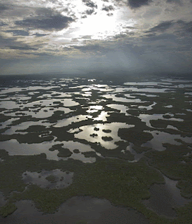
The Florida Everglades
The everglades, also known as 'the river of grass',  covers
some 11,000 square miles of land in south Florida. (4)


 1)www,physicalgeography.net/fundamentals/7rhtml
 2)http;//www.wsvnnews.com/weather/blog/posts/mI94374   
 3)NWS Jet Stream-North American Masses


Thursday, March 8, 2012

Weather and Climate in Florida


Weather and Climate in South Florida

Florida boasts powdery white sands and emerald waters on its gulf shores in Pensacola, Tampa, and St Petersburg. To the east on the shores of the Atlantic Ocean, from Cocoa Beach down through Fort Lauderdale and all the way to Key West are soft, wide beaches stretching for miles. A year-round warm climate and an abundance of sunshine have enhanced Florida's popularity for years.
Florida is one of the largest states east of the Mississippi River, and only Alaska and Michigan are larger in water surface area. South of Lake Okeechobee the climate is considered tropical.  Mean high temperatures for late July are primarily in the low 90 degree Fahrenheit with mean low temperatures for early to mid-January range in the low 40 degree Fahrenheit.
The seasons in Florida are determined more by precipitation than by temperature, with the hot, wet springs and summers making up the wet season, and mild to cool, and the relatively dry winters and autumns, making the dry season.
Certainly worth mentioning are hurricanes that pose a severe threat during hurricane season, which lasts from June 1 to November 30, although some storms have been known to form out of season. Florida is the most hurricane-prone US state, with subtropical or tropical water on a lengthy coastline. From 1851 to 2006, Florida has been struck by 114 hurricanes, 37 of them major—category 3 or above.  


Weater and Climate in South Florida